
A Prehistoric Metropolis on Salisbury Plain
- Paul Timlett
- Mar 9
- 15 min read
Updated: Apr 3

An early spring morning dawned misty but bright. The forecast was for early fog but brightening later. So my usual walking buddy Stu and I set off for Enford to do a walk I’d planned before the winter but been prevented from doing by rain and the usual demands of life. Over the course of the day we enjoyed the Plain at its best. Until late afternoon we saw only one other walker and a few Fusiliers on a map reading exercise. The glory of the Plain is that in areas that are not red flagged the walker is free to roam anywhere other than woodland, although that presents its own challenges. In order to do this walk you need to be able to read a map and be prepared to adapt – what you see on the map is not always reflected by what you see on the ground. A footpath may be marked on the map but be entirely absent in the landscape whilst nearby an unmarked gravel road or clearly defined track may lead you to where you want to go. At times we crossed scrubby open grassland which was a little heavy going. This is not a walk for those of limited mobility I’m afraid.
We parked in the gravel car park next to the church of All Saints and St Margaret in Enford. The mist still hung in the early morning air which meant that visibility on the Plain would be limited so we spent some time in and around the church as the sun got to work burning off the remains of the mist.

Enford is not a large village which makes this substantial 12th century building (and almost certainly earlier as there is a stump of a pre-Saxon cross outside as you approach the church) seems slightly out of place. Its size seems disproportionate to its parish so I suspect it has grown over the centuries to reflect its place in the hierarchy of mother daughter churches. Certainly it was added to in the 13th, 14th, 15th and 18th centuries. I’ve been reading about the relationship of neighbouring churches and how churches generated significant revenue from burials. This led to one church dominating the area such that the bodies of people from neighbouring settlements were transported to the mother church to be buried. This is how coffin trails came about which led me to wonder whether some of the local footpaths originated as coffin trails and whether any such trails have been lost, waiting to be re-discovered and entered on the definitive map of public rights of way. The size of the church yard at All Saints and St Margaret may support this theory, as might the presence of a coffin bier inside the church. The churchyard is huge with ample space to accommodate many more!

But whether or not this church is a mother church, it clearly has had some wealthy benefactors as each addition added significantly to its footprint. It housed the local school from as early as 1552 until the late19th century. What caught our eye was the kneeling statue of Mrs Jennifer Baskerville on the ledge under what is known as the Baskerville window. The Baskerville family trace their origins to Herefordshire but her husband, William Baskerville was from Wanborough in Wiltshire. Little seems to be known about Jennifer but her memorial here, and the adjacent picture frame containing the Baskerville family tree back to 1194, suggests she was a local woman. It would be nice to know more about her and how she came to be memorialised here.


There is so much more to see in this magnificent church, not least of which the lychgate which gives access to the churchyard from the car park and the magnificent grade II listed thatched cob wall around the garden of the late 17th century Enford House which was once the vicarage.

It’s worth looking at the perfectly located Manor Cottage across the meadow behind the church. Its grand approach belies the size of the cottage at the end of the gravel drive. However, we had a long walk ahead of us and decided it was time to get going.

We followed the road towards the village and over the bridge across the River Avon. At the T-junction you will find a useful village interpretation board providing a lot of information about Enford and the surrounding area, including the two objectives of our walk – Lidbury Camp and Chisenbury Warren. You can find a digital version of that information board here:
At the junction we turned left but just round the bend to the right is The Swan pub. There used to be an arch over the road here with the pub sign dangling from it above the road. A couple of years ago it disappeared and you can see where the upright of the arch has broken off outside the pub. I’m not sure what happened but it’s a sad loss – I can only think of one other place where I’d seen such a feature and that was in the town of Crawley in Sussex where I grew up. Probably the town’s only redeeming feature. Swindon has got nothing on Crawley. The Swan was closed for some time but happily it has re-opened as a community pub. Stu and I did have a quick look to see if it was open at the end of the day after our walk!

Passing Water Lane we continued north along the quiet country road past the lovely Littlecott Mill. Over the course of my lifetime in Wiltshire I’ve cycled past this house many times. It’s location next to the river and its beautiful gardens are perfect. I’ve often imagined what it must be like sitting in the garden listening to the sound of the gushing mill stream. A little way after the Mill a track above and to the right doubles back on itself and you climb steeply towards a pair of cottages now looking back down on Littlecott Mill and its gardens.

Through trees and across fields you can see All Saints church nestling in the Avon valley. At the top of the climb by the drive towards the cottages the track bends sharp left and we now begin a 4 to 5 kilometre walk almost in a straight line to our first destination, Chisenbury Warren.

By now all that remained of the mist was a soft haze which provided a gauze like filter to the wide ranging views. We soon reached an enormous communications tower which can serve as a bit of a navigation aid during the walk as it can be seen from a great distance. As we followed the grassy track further out onto Salisbury Plain we basked in the now warm sunshine listening to Skylarks high above and all around us. At the time of our walk there was a big military exercise going on and the sound of artillery fire sounded a little closer than it actually was. We could also hear small arms fire from the firing range just outside Tidworth. But for me this was a refreshing change from the constant hiss of traffic which is ever present in my part of Wiltshire. The intermittent sounds of military training are somehow more tranquil.

As we continued along the ridge line, looking down into the wonderfully named Rainbow Bottom on our right, we could see about a kilometre away a Landrover in the field and the unmistakable figures of a handful of soldiers. As we looked we could see other lonely looking figures out on the Plain. The Landrover headed off and sometime after we heard someone running up behind us over our right shoulder. A young recruit was running across the slopes from Rainbow Bottom with a rucksack on his back. He managed to gasp out a greeting as he passed before slumping down in a heap a hundred metres ahead of us. He pulled out a map and compass and began plotting his route to what was obviously his next waypoint. He was little more than a boy but as we exchanged a few words he was clearly confident in what he was doing. As the soldier raised himself for the next leg Stu remarked that he’d spent longer queuing in the NAAFI than this young guy had spent in the army!
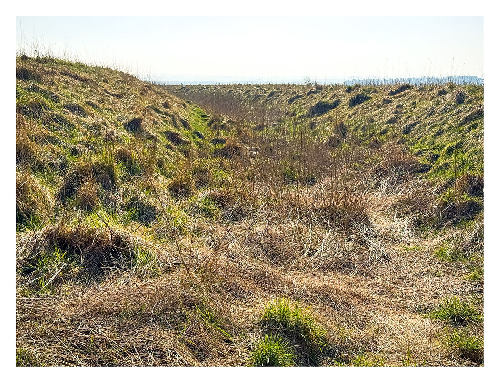
At this point on the walk the way becomes less clear. We were using the OS Maps app on our phones and whilst we were supposedly on a bridleway there was no sign of it on the ground. So we took bearings towards obvious points in the landscape, a tree here or some scrub there, and made our way to each before taking another bearing. We were aiming for a reservoir and tumulus marked on the map. Within a couple of hundred metres we could make out the shape of a burial mound but it was completely overgrown with bramble and hawthorn. Just beyond that was the reservoir which was being used as a checkpoint. The young guy had reached it safely and was being checked in by another soldier before starting another leg. We decided to stop for a coffee by the checkpoint and chatted to the soldier who was manning it. He explained that they were a unit of the Fusiliers and that they were running a map reading course for young recruits over a course of 9 kms. The guy we had seen was just 18. They were scheduled to do a further 9 kms later but this time in the dead of night!

Finishing our coffee we headed off again down the slope in front us, but not before peeling off a layer as the temperature climbed. It was now a gloriously warm sunny spring day. There was a deep muddy track to our right but we stayed on the tussocky grass above it and very soon came to a wide chalk military road which is also a restricted byway. There are several public rights of way signs around here. Some pointed to obvious paths or tracks but others just pointed across open grassland. If you look at the OS Map for this area you will see just how many public rights of way there are but of course on foot we can roam anywhere. These public rights of way long pre-date the military’s presence here and it’s intriguing to wonder about the origins of these trails. They have existed for hundreds of years but what were they for? Where were people coming from and where were they going to? Whilst there are a few farms dotted across this landscape and they are connected by what are now rights of way, there are no signs of enclosure and intensive arable farming (the land is too uneven for anything other than small terracettes) so why didn’t our ancestors just wander across the open grassland like we can now? Well maybe that’s the clue. In anything but clear weather this inhospitable landscape is difficult to navigate so perhaps the security of a well-worn path was necessary and welcome?
And this leads me to one of my regular rants. Anyone who has read by blogs before will know that I like the occasional rant. And you might also know that I am an advocate of improved access to the countryside for all. One of the pushbacks we often see from landowners and their representatives at the NFU and CLA is that the general public can’t be trusted in the countryside – that they would trash it by leaving litter and dog mess. Much of Salisbury Plain is in effect an open access area and has been since the military took it over as a training area. As I have said elsewhere here walkers are free to walk anywhere other than areas controlled by red flags or woodland. We are not required to stick to public rights of way which is fortunate on this walk as often it is impossible to stick to the line of a right of way as shown on the OS map. On this walk we saw no litter whatsoever other than the odd piece of army training detritus such as the two spent smoke canisters we found. Yes we did come across a couple of piles left by dog walkers but these were close to Enford (still no excuse for it) as on the whole dog walkers don’t seem to stray far from their homes or cars. Once we got beyond a few hundred metres of the village we saw none. Now that is not to say that littering isn’t a problem around tourist honeypots and car parks, but I’ve never seen any evidence of dedicated walkers leaving litter during the 30 years or so I’ve spent wandering on the Plain. I’d like to think we have learned to love and respect the countryside and to look after it.
Right that’s my rant over with – back to the walk. We headed northeast along the road for about 1.5 kms where we were passed by a couple of guys on mountain bikes. Soon we started to see earthworks, the unmistakable sign of ancient field systems. These led us to Chisenbury Warren.

Chisenbury Warren was a Romano-British settlement and is in a remarkable state of preservation. It covers an extensive area and on the slopes below a scrubby area, the warren itself, there are clear remains of the 30 or so hut platforms. The area is surrounded by a fence but much of it has been flattened so we ventured in. The fence is intended to protect this ancient monument from damage from military training. A Landmark vehicle appeared on one of the roads but they weren’t remotely interested in us and soon drove off. Landmark are responsible for safety and security on the Plain. It was clearly part of a much wider area of occupation that was settled and farmed by our Romano-British ancestors 2000 years ago. The field systems are extensive here and it’s easy to imagine them farming the terraces that proliferate this landscape. As we gazed across what is now an empty landscape we imagined what must have been the hundreds of people that once lived here. Interestingly, looking at older maps right up to the 1937-61 1:25,000 OS Maps there was an extesnive area of woodland called Jenner's Firs immediately to the north of the warren. Much of this has now gone and what is left starts about 0.5 kms to the north.

From Chisenbury Warren an ancient trackway leads to Lidbury Camp which demonstrates that the two places were contemporaneous. However Lidbury is much older having been established in the Iron Age. We didn’t follow this ancient trackway but followed the bridleway shown on the OS map which exists as another wide chalk military road heading northwest along the edge of the warren. On reaching a junction of chalk tracks we left the bridleway, turning left to follow another military track westwards across Littlecott Down. On our right was a small area around which were dotted signs warning of ground nesting birds, with the hangars at Upavon visible in the distance behind.

We ascended a gentle climb passing along the edge of sparse woodland where we decided to stop at the side of the track for lunch. It was here that we met the only other walker that we were to see until much later in the day. A man in a cardigan, wellington boots and carrying a thumb stick. Not the nylon clad walker in expensive walking boots that we sported.

After lunch we descended the track to a muddy spaghetti junction before climbing again dead ahead, passing a disused pit on our right. To our left a few hundred metres across open grassland we could see a fenced off area – this was Lidbury Camp. Again the tell-tale “No Dig” signs dotted along the fence line showed that the purpose of this fence was to protect it from damage by the military. We crossed the open grassland to the fence and found a section that had been flattened so we walked over it towards the earthworks before us.

Lidbury Camp originates from the Iron Age but was in use during the Romano-British era. I shot another piece of video here but the camera doesn’t really show just how well preserved this ancient monument is. The ditch from which the earth bank was dug is still 2-3 metres deep despite millennia of erosion. We owe its preservation in part to the fact this is a military training area. Close to the southeast corner is what looks like a dew pond, presumably used for watering livestock. The camp is a univallate structure so my assumption is that this was an animal enclosure. Also at the southeast corner is the entrance and a track marked by an earth bank which leads from Lidbury towards Chisenbury Warren. This might support the theory that Romano-British people lived at Chisenbury Warren and sheltered their animals at Lidbury Camp? The two are no more than a kilometre apart and there is an extensive system of earth banks between them suggesting strong links. But I am no historian so would love to know if this interpretation is correct.
As we stood on the earthworks of the camp it occurred to me how advantageous a position Lidbury Camp was. The views reach to the horizon in every direction with ancient field systems everywhere. Once again I imagined just how many people there may have been out here 2000 years ago. Many more than we could see today. Off in the distance we could see a figure standing beneath a tree. The figure didn’t move for quite some time. It wasn’t our friend in the cardigan as we could see him making his way back towards Chisenbury Warren along the line of the old trackway linking the two. So whoever we could see was presumably just soaking up the tranquillity of this beautiful calming day. Shortly after I looked across to the tree again and the figure had vanished.
From Lidbury Camp we re-joined the chalk track we had been on before we struck across the field to the camp. Passing yet another ancient field system and another sparse area of woodland we looked across to the buildings of Chisenbury Field Barn to our left, silhouetted against the sinking sun and the gentle haze.

There is a footpath marked on the OS map that passes right by the barn. Do not be tempted to use this. We did and found that there was no sign of a path. Indeed the ground was quite treacherous here, carpeted with thick tussocky grass and many hidden holes. So stick to the chalk track to the north that climbs in a westerly direction above the barns. It gets a little rutted in places and will be very muddy in wet weather but you can just walk in the short grass either side of the track if the going gets too sticky.
We followed this track for about a kilometre where it descended steeply to another junction of tracks where we turned left in a southerly direction for a few hundred metres before coming to a wide chalk road. There are several public right of way signs at this point but we crossed this road following the well worn grass path for a few tens of metres where we turned right to follow what was now a grassy public footpath that soon turned right then left on its way to East Chisenbury, all the time the way clearly sign posted by public footpath signs. High above us to our left on the opposite ridge was the communication tower we had passed at the beginning of the walk. We were tired and hot and starting to become a little hysterical. I wondered how long the tower had stood on this ridge and whether our ancestors had moaned about it like we now do about everything. Stu reckoned in the Iron Age people probably took to Slatebook to have a moan and generally make stuff up.

Towards the end of the path we came to a couple of benches on the bank above the path. A wonderful peaceful spot on which to while away some time. There were a few flints laid out in a semi-circle around a lavender and a rosemary bush.

We assumed it was some sort of shrine or memorial garden. Just after this point the path descends beneath a canopy of trees and emerges in East Chisenbury next to the famed Red Lion pub which sadly was closed. Boy we could have done with a pint. But just a pint. The food prices were eye watering, I guess in no small part due to the fact that the pub once had a Michelin star. Some good friends of mine who have much deeper pockets and have made much better investments decisions than me are regulars there. They say the food is spectacular but that the pub gave up its Michelin star due to the cost and admin of maintaining it. So fair play to them.

At the pub we turned left along the road for a short distance. I’ve cycled along this Avon valley road countless times and always managed to cast an eye across to Chisenbury Priory. It was only when I was planning this walk that I realised there was a public right of way through the grounds. So we turned left off the road just after the pub through what is the back gate of the Priory.

As you look at the entrance you wouldn’t think there was a right of way here, but behind you on the opposite side of the road is a public footpath sign pointing up the drive. We followed the drive beside a high wall where it then swings right into the yard by what I assume were once stables before turning left again to provide a magnificent view of the front of this handsome 17th century building which you can see at the top of the page. It is thought it was built on or near the site of a cell founded in 1112 by the Abbey of Bec-Hellouin in France, the only ecclesiastical connection.

Turning our backs on the Priory we walked up the long drive to the grand entrance gate on the valley road, pausing frequently to turn and admire the verges strewn with flowers and the avenue of trees leading our eyes back to the Priory. There is a pedestrian gate next to the main gate. We the turned left to amble along the road back to Enford, passing Littlecott Mill once again. More in hope than expectation we had a quick look at The Swan in Enford but it too was closed.

This was a 12 km (7.5 mile) walk which shows Salisbury Plain at its best in early spring. A warm sunny day with Skylarks singing overhead. Red Kites, Buzzards and Kestrel were everywhere. You might even be lucky enough to see Curlew, Stone Curlew, Montagu’s Harrier and Great Bustard out here. What you won’t find is many people. The views go on forever. Yes the ground was a little heavy going in places and you need to concentrate on your route finding. But if you follow my map you won’t go wrong.

Some years ago I took my dear departed Dad for Sunday lunch at the Red Lion after we had visited some of our old birdwatching haunts on the Plain because it was conveniently located and the menu looked nice. Should have paid more attention to the prices...