


Lacock and The Wilts & Berks Canal
- Paul Timlett

- Feb 8, 2022
- 10 min read
This is a blog that’s been 17 months in the making. I first discovered the Wilts & Berks Canal completely by accident in September 2020. I’d taken my son’s car for a service near Pewsham and decided to take a walk whilst I waited. I looked at my OS Map app to see what was nearby and noticed the legend “Old Canal” and "Pewsham Locks (disused)" around half a mile away along a footpath that started very close to the garage. This immediately grabbed my attention and wearing inappropriate footwear I struck out across the muddy fields. What followed was a fascinating couple of hours which I wrote about in a post in the Hidden Wiltshire Facebook Group on 2nd September 2020.
On this initial walk I discovered a hive of activity. Several volunteers working for the Wilts & Berks Canal Trust were involved in restoration work around Pewsham Locks. I had a long chat with one of them, Dave Maloney, who explained a little of the history of the canal. As I wrote at the time the locks form part of the disused Wilts & Berks Canal which runs for 52 miles between Abingdon and the Kennet and Avon Canal at Semington. It was completed in 1810 to mainly carry coal but the canal was abandoned in 1914. The canal is now being restored and they’re doing the entire length! At Pewsham they are restoring three locks and the lock keeper’s cottage. They’re already doing boat trips on the short stretch that has been restored to the south. One of the locks here is in pretty poor shape as the army used it for demolition practice in the Second World War. I wondered whether it would be possible to put together a circular walk in the area that would take in this length of the canal. Dave explained that he had already sketched out an idea for a walk which he subsequently emailed to me. It’s taken me a long time to refine it!
Scroll forward to February 2022. Glyn and I are big fans of the music and writing of Andrew Rumsey, the Bishop of Ramsbury. Andrew publishes short YouTube videos most days and one day recently he mentioned that he had been walking with a fellow clergy member who was local to Chippenham who took him to see the canal. Andrew admitted to never having heard of it. The cat was out of the bag so I decided I needed to get on and do the walk whilst the canal was still relatively hidden!
On a rainy Friday morning my regular walking buddy Stu and I got in his car for the drive to Lacock. Once again the prospect for the weather was not looking great. One of us is jinxing it and I’m not sure who! However, by the time we got to Lacock the rain had stopped and the sun had broken through to provide us with azure skies dotted with white fluffy clouds. If it hadn’t been for the biting wind it could have been a summer’s day. I’m not a great fan of Lacock but as a member of the National Trust the prospect of free parking at a convenient point on the walk could not be ignored.
My issue with Lacock is that it’s become something of a theme park. There’s no doubting that many of the buildings in this medieval village are beautiful but over the many years I’ve known it the place has become so commercial. There are advertising signs everywhere. We counted eight around the George Inn alone.

And the streets seemed buried under parked cars. I know the residents have to park somewhere and I guess if there were no cars the village would appear even more of a theme park. I suppose I want my cake and to eat it! Nevertheless, because it was still early, there were few people around so we explored the village and took advantage of the deserted streets under blue skies to take a few photographs.


As a photographer I wanted to pay homage to William Henry Fox-Talbot who is buried at St Cyriac’s Church. He is claimed by many to be the inventor of photography, although the French would beg to differ due to Louis Daguerre's invention of the daguerreotype in early January 1839. The churchyard of the 14th century St Cyriac’s is a fascinating place with many very old and grand tombs signifying the wealth of the wider area but we failed to find Fox-Talbot’s grave, although we did find several calling cards left by dog walkers (honestly why would you leave that in a church yard)?
We didn’t spend a lot of time in Lacock. Let’s face it, it’s hardly hidden. We were keen to reach the main objective of the day – the far less well-known canal. From the church we headed down the narrow lane called Nethercote to the ford and crossed the ancient packhorse bridge over Bide (or Byde) Brook and then across the meadows towards the hamlet of Reybridge.

Here we came to another old bridge that crosses the more substantial River Avon. It seems the rather inconsequential looking lane carried by the bridge was once an important trading route between London and the cities of Bristol and Bath, and that the nearby Cuckoo Bush Farm may have been a drover’s inn.

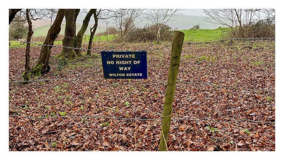
Once across the bridge we struck diagonally left across the meadow towards Ray Mill. We were getting closer to our goal. Now as far as I can tell Ray Mill is famous for one thing. As an avid reader of Hello! magazine (I’m not, I’m really not) Ray Mill House was bought by Camilla Parker-Bowles after her divorce in 1994. According to the magazine she bought it because it’s only a 15 minute drive from Highgrove House, the home of Prince Charles. Now either Camilla had a very fast car or the person who wrote the article needs to get out of London more! Either way Camilla apparently still keeps the house “as a base”. The footpath we were on took us round two sides of the estate which was hidden behind some fearsome looking fences, barbed wire and bristling with security cameras. Not sure whether they’re designed to keep someone in or us out but it all seemed a bit excessive if the house is largely unoccupied. Not that you can see anything other than the odd chimney. Seems such a waste when so many people struggle to put a roof over their head or food on the table.
Anyway, after crossing more very boggy fields we soon came to the start (or the end) of what can currently be seen of the canal, marked as under construction on the OS Map. This is as far as the Canal Trust has reached with their restoration work. An interpretation board headed Pewsham to Lacock welcomes you to the tow path with a flavour of what you will find on your journey along this section to Pewsham Locks. This really is a most beautiful, peaceful spot. As we ambled along the path we were accompanied by the plentiful waterfowl in the rushes and reads.


As the canal becomes clearer and navigable, to the left the River Avon twists its way ever closer to the embankment along which the canal travels. A bench provided the perfect place for a coffee. As Stu and I sat quietly taking in the view and soaking in a little warmth from the sun, a delightful couple approached along the tow path clearly enjoying the experience as much as we were. We chatted for a while and it transpired that, living in Bradford-on-Avon (or was it Corsham!), they had heard of Hidden Wiltshire. So if they’re reading this it was an absolute pleasure to meet you.
Having put the world to rights we ventured on our way. We made a short diversion down the raised earthwork to the banks of the Avon. This again is a truly delightful spot, where I had seen a kingfisher during my previous visit in 2020. A short distance further the Avon snakes away from the path of the canal again, forming a horseshoe on its way to Lackham College. I paused to take a couple of images of the canal and the sun dappled tow path, and soon came to the first of two horseshoe spill weirs along this stretch.


These beautifully engineered brick built structures are designed to remove excess water from the canal in times of flood, channelling it away to the river below. We then came to the first of the locks that the Trust is restoring. I have to admit the work seemed to have gone backwards since my last visit as there was even less of the original structures visible than before. And the works were now protected by high site fencing. (The images in this blog were mostly taken in 2020 when the site fencing was not in place further down the canal.) But it’s clear that much of the original structure is having to be removed and cleaned up or replaced entirely before reassembling it.

There is clearly an awful lot to do and the Trust will need to raise a huge amount of money. I am in awe of their dedication so have linked to their website in case you want to assist by volunteering or making a donation.

We spent some time reading the very informative interpretation boards and admiring the engineering work before crossing the top lock to the other side of the canal. From here we navigated our way due east across very muddy fields towards the junction of the A4 and the A342 Old Derry Hill emerging at the entrance of the drive to Pewsham House. We then turned 90 degrees to walk south along the metalled lane towards Nocketts Hill. There are good views to the right to Pewsham House. This is a fine looking house whose appearance belies its relatively recent date of construction of 1892. It was built to look vaguely Elizabethan.

On the way I was stopped in my tracks by the sculptures in the yard of Nocketts Hill Barn on the left before the lane dips then climbs up towards the cottages as Nocketts Hill.

As you climb the road the views open up to the right and behind. Passing through an open gate on the right between cottages we came to an open field with the unusual looking house at Nocketts up to the left. Keeping to the contours we crossed the side of the hill towards a stile (or was it a gate) before reaching another metalled road that climbed from the valley to our right. Turning left onto the road we crossed the cattle grid where we found a log and a stone by way of table and chairs perfectly set out for lunch!

The views from our dining area were far reaching to the north. At the risk of causing offence Chippenham did spoil it a little but in the fresh clear air of a winter’s day we could see forever. In the middle distance we could see the works at Pewsham Locks where we had been earlier.

Lunch over, and with a warming swig from our hip flasks, we set off continuing steeply up the road which flattened and curved its way to the top of the hill above Ash Hill Farm. We were interested to see what remained of the earthworks marked “fort” on the map. This was Naish Hill hillfort. And the answer was “not a lot”. In what is a dreadful picture of a bunch of telegraph poles and wires you can just make out the slight earthwork barely a metre high in the field. Not wishing to trespass we stayed on the road looking over the metal farm gate at the junction. The fort is a rectangular univallate Iron Age hillfort with a single bank and ditch. Unsurprisingly Roman pottery has been found here. The whole area is rich in Roman history with a Roman road to the south and the remains of a Roman settlement at Sandy Lane. However, there is little remaining of the hillfort and nothing to detain us here any further.

From the junction we turned left along the road for a short distance to some cottages just before Kilima Farm. Climbing the stile on our right and crossing a field containing horses we were aiming for the footpath behind the cottages which turns left across the fields behind Kilima Farm towards Second Nursey. I’ve been unable to find anything out about the farmhouse other than the fact that the farm is home to a campsite. But it’s a substantial looking house built for what must have been a wealthy farmer. From here the path passes through the woods before descending and turning west through Bowden Park.

As we tracked down across the fields, Bowden Park emerged from over the brow of the hill to the left. This substantial country mansion was built in 1796 for Bernard Dickinson with money from the slave trade. The Dickinson family had plantations in Jamaica from 1655 and were one of Wiltshire’s foremost exploiters of slave labour. Later, in 1849, the house was bought by John Gladstone, brother of British Prime Minister William Gladstone. In 1967 it became the country seat of Arnold (Lord) Weinstock, Chairman of the General Electric Company. In 2020, after the death of Weinstock’s widow, the estate was put on the market at a price of £35m. I’ve no idea who owns it now. Google returns no information on that.

Eventually, at the bottom of the hill, we crossed Bewley Common to join the road that descends Bowden Hill from the direction of Sandy Lane. Here we took a short diversion along the road to Bewley Green to have a look at Bewley Court, a grade 1 listed 14th/15th century manor house. I’d read somewhere that it was open to the public but the high wooden gates off the road were firmly closed and only the top of the roof visible. The gardens are reputed to be stunning so I shoved my camera lens through the gates of the delivery entrance to grab a picture of some of them.

Dodging several horse boxes the size (and price) of a small house we walked along the lane back to the Bowden Hill road. We crossed the famed bridges across the Avon, the earliest part of the structure being medieval, and as soon as we could dropped down into the park in front of the Abbey.

Walking across the bridge is quite risky. The road is single track and there is little space for pedestrians. Stu and I waited for a gap in the traffic and marched to safety as quickly as we could. I strategically positioned him in front of me as he’s a bigger target than I! From the bridge it was a short stroll across the park before we crossed the road back to the car park.

In all this walk was just over seven miles, and was very muddy in places. You do get a very distinct sense of the immense wealth that once and still does inhabit this part of the world, some of it on ostentatious display today. But overlook that and you’ll see some beautiful, historic buildings together with a fine example of the country’s industrial past and a mode of transport that powered a revolution. Beyond that are hints of a history that stretches back to the Iron Age via the Romans. I’ll be keeping a close eye on the progress the lovely people at the Canal Trust make in their epic restoration project.


Very interesting read thank you, always enjoy walking along the canal, my late husband was a supporter of the trust he would have loved to have seen the progress made since his death in 2010
Janet Nuthall